INTERACTIVE MAP
START PROCEDURE
There will be a commom Elite start, and a Rolling Start for the rest of the triathletes not certified as elite, whose bib number order will be the estimated swimming time indicated in the registration. The type of start (Elite or Rolling Start), will be selected by the participant when registering but if the elite start is chosen, this condition must be accredited according to the following criteria:
- A quota of 50 places of each sex (female/male) is established for the Elite start.
- If the quota of elite places offered is exceeded, the following selection criteria will be applied:
- Classification of the Infinitri 113 Triathlon Peñíscola 2023.
- Top ranked in the FETRI 2023 Half Distance Ranking.
- 10 places at the discretion of the organizer
- Registration order
- The Elite start will take place in the same wave, separating the male start from the female start.
START PROCEDURE
Elite:
In the first place, the elite category will start, first the male start in a common wave, with all the elite male participants, and later the female start with all the elite female participants.
Rolling Start:
Subsequently, the start procedure will begin in Rolling Start. First of all, the participants will access a pre-start zone where access will be controlled.
After the pre-start, you will go to a call room where the participants will line up in 6 rows under the start line, to make way for the start, where 6 triathletes will start every 6 seconds. Time starts running from the moment the chip control is passed at the starting line.
SWIM: 1,9 KM
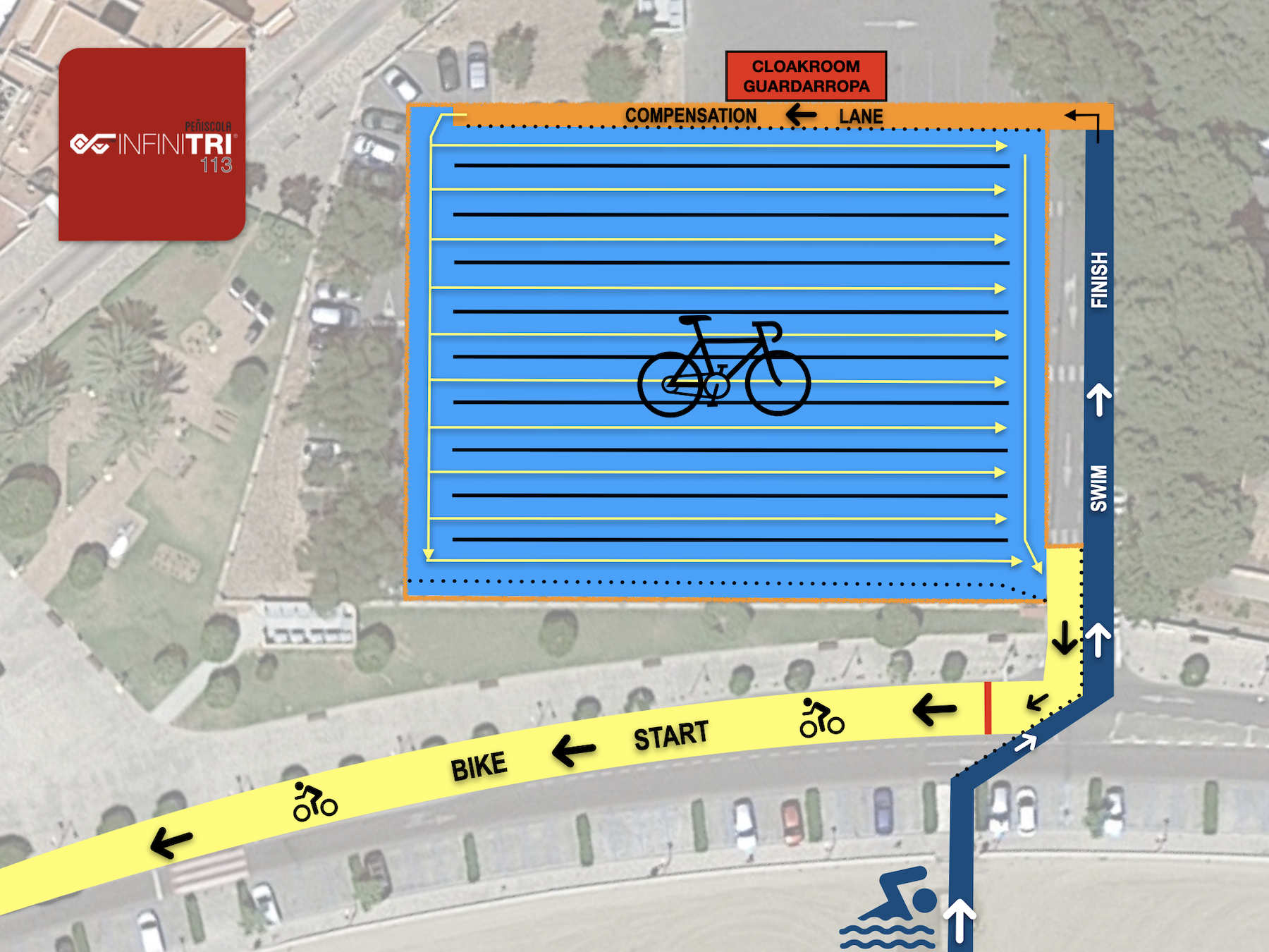
The start of the Infinitri 113 Triathlon Peñíscola takes place on the North beach of Peñíscola, where we will start swimming a few meters from the mythical Templar Castle. We will continue surrounding the tombolo in a clockwise direction until we reach the port basin, always with a safety margin with respect to land. The route will be marked with clearly visible buoys at each curve. The arrival at the South beach will be clearly delimited by a finish arch that serves as a reference for the participants, and will give way to the transition area to make the first change of discipline.
Depending on the temperature of the water, the use of neoprene will be allowed, mandatory or prohibited, although due to the date the race is held, it is very likely that it will be allowed and not mandatory. The corridor to the transition zone on the south beach is a stretch of 75 m of sand and 50 m of street.
A security corridor will be created between the rescue vehicles and the support canoes to guarantee that all participants do the segment through the indicated areas. In the event that the weather advises against carrying out the swimming segment along the original route, a plan B is planned where you would swim entirely on the South beach to avoid risk situations.
BIKE: 85 KM
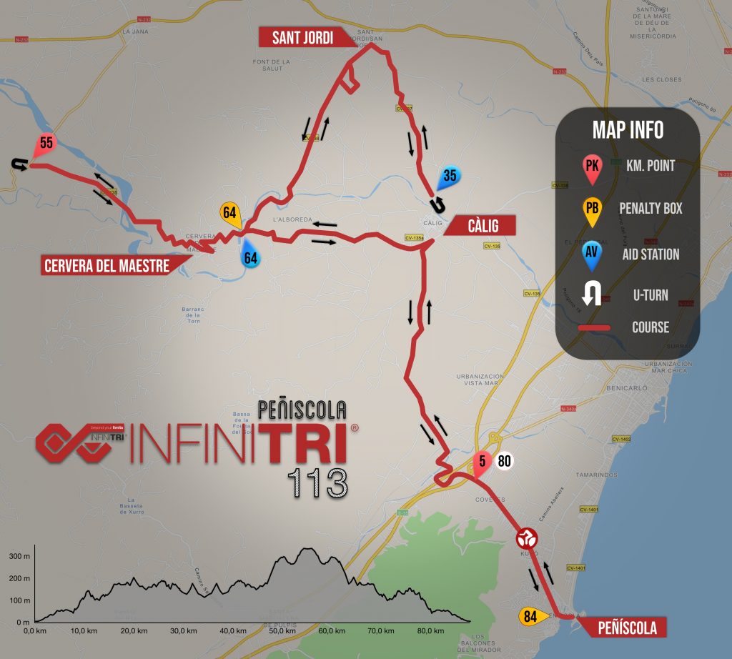
The bike course begins on Calle Akra Leuka and then Avda. Estación to leave Peñíscola heading west in a long 5km straight. Once we reach the CV-1340, a slightly ascending zone begins (140m of gain in 15km) until we reach Càlig. In Cálig we begin a round trip to Sant Jordi, and again in the direction of Càlig. From there we will make a 180º turn to head towards the town of Cervera del Maestre, to cross it towards Sant Mateu, where a few kilometers before we will make a 180º turn, already back towards Peñíscola. It is a fast and undulating circuit in which we will move between 100 and 330 meters high. These roads stand out for their excellent paving and tranquility, since on a normal day few vehicles pass through it.
IT WILL BE COMPLETELY FORBIDDEN TO CIRCULATE IN THE LEFT LANE IN THE DIRECTION OF TRAFFIC, THIS WILL LEAD TO IMMEDIATE DISQUALIFICATION. THE TRAFFIC REGULATIONS MUST BE FOLLOWED AT ALL TIMES.
Located at the 180º turn before Cálig and near the Cervera town, heading back to Càlig. Click on each image for nutritional information.
Penalty box: Located near the town of Cervera, heading back to Càlig, km 64 and in Peñíscola before T2, km 84. It is mandatory to stop at the Penalty Box on the lap that has been penalized. If a drafting penalty is incurred in the last section towards Peñíscola, the penalty will be enforced just before entering the transition area. Failure to comply with these sanctions will lead to disqualification.
RUN: 21,1 KM
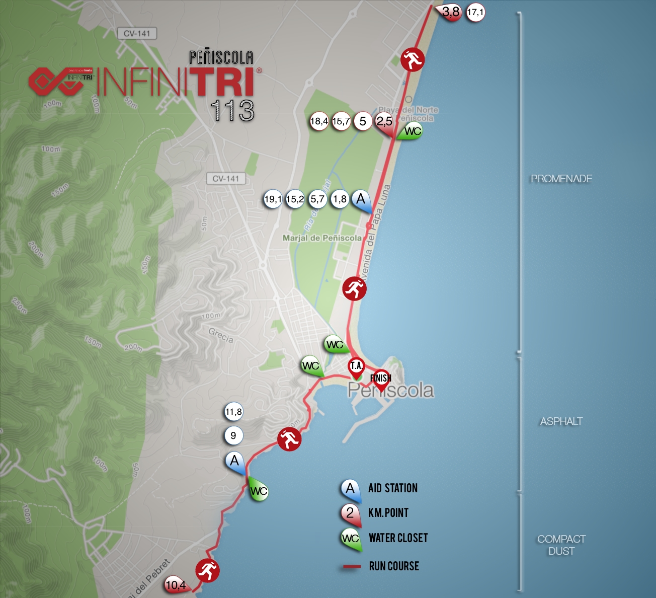
The 21.1 kilometer run course is divided between the seafront in the northern part of the town, and the area of virgin coves of the Serra D’Irta Natural Park, in the southern part. The promenade, after its remodeling a few years ago, has become an excellent area for running, which is totally flat. The area of coves is an undulating terrain where we will run a few meters from the sea, enjoying spectacular landscapes. Thus we can enjoy the views of Peñíscola Castle from the southern part and also from the northern part. We will start heading north along the beach promenade with the first 8 kilometers completely flat, turning 180º at km.4. Then we give way to about 6 kilometers through the undulating southern area. Back in the old town area, we will take another tour of the north area to complete the 21 kilometers.
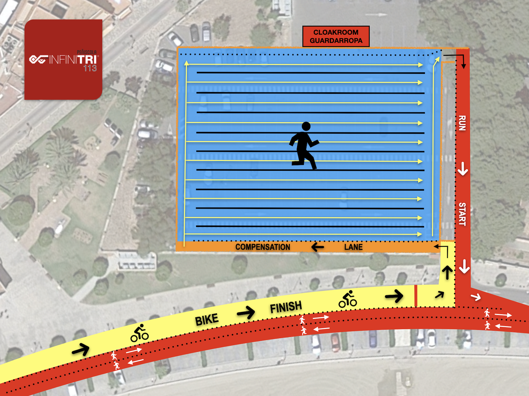
Once completed the course, we will head towards the castle area, where we will reach the finish line located in Plaza Santa María.
2 bidirectional aid stations, in total 6


